Sentinal mineral reserve inc.
Gold Exploration
New technology is making overlooked Gold Deposits viable for development and production
Gold's Timeless Alure
The price of gold, which like all precious metals can be volitile, has been steadly increasing in the long term over the past thirty years and will continue to do so for the foreseeable future.
Demand for gold is at a record high, however mine production has remained steady at 2,250 tonnes per annum (Source: World Gold Council).
Declining gold production vis a vi increased demand, a weaker national currencies due to excessive debt levels, deficit spending, conflicts around the globe, and shrinking economies are some of the many factors that are driving gold prices higher.
Gold is also now moving back into the monetary system. The strong desire for dollar independent currencies has seen more countries repatriating their gold reserves and backing their currencies 100% by gold. Even in the US their is talk of a return to the "gold standard" to back the US Dollar. The impact of this on gold pricing will be substantially positive.
The increase in demand will mean new sources of gold are required. Gold reserves which in the past were considered too expensive to are now viable. By introducing advanced exporation technology and modern mining techniques to areas of the world where traditional mining practices are still the norm more gold can be located and mined for a lower cost, thus maximizing profitability.
SMR INT is constantly seeking to aquire an interest in gold projects of this nature and providing the seed capital and technical expertise to develop these projects to the fullest potential.
Placer Gold
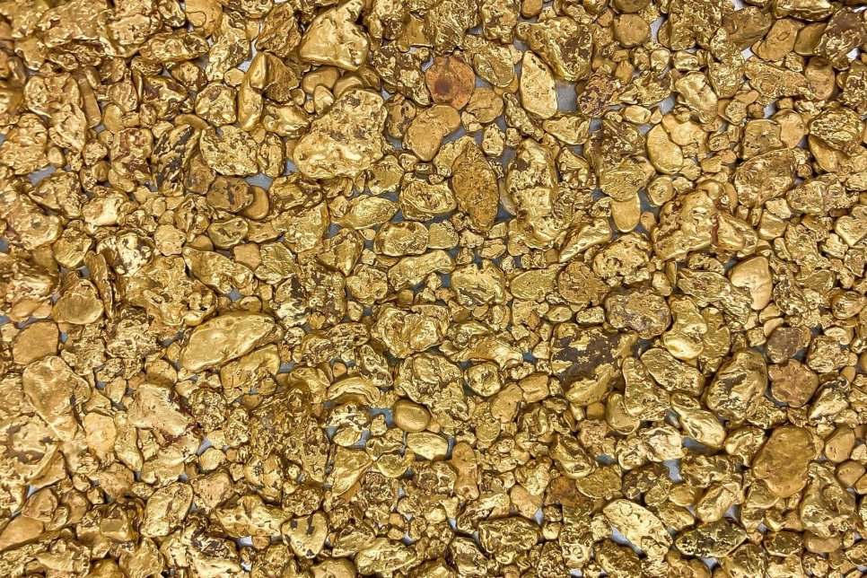
Placer Gold is the gold particles that are released from the bedrock veins by erosion and end up in being concentrated in riverbeds, bench gravels and on beaches. These particles can vary in size from small particles, fine flakes or nuggets. As a heavy material they settle in loose sediment and can be accessed by panning, sluicing or dredging. Placer Gold is usually 70% to 90% pure and alloyed with silver.
Characteristics and Types
-
Formation: Weathering breaks down the hard-rock gold sources, which are then washed or transported by water or gravity to be deposited in lower-velocity zones where it is too heavy to be carried further.
- Physical Properties: Place Gold is rarely pure and often appears with silver, copper or other impurities. It's weight and density allow it to settle but it's malleability will cause it to become flattened or rounded during transport.
Deposit Types
Placer Gold is found in geological areas where gold-bearing veins have been exposed to, or eroded by, water. Placer Gold deposits can range from a few meters to over 30 meters in depth, with the gold concentrated near bedrock or in specific layers of gravel.
- Alluvial/Stream Placers: Found in current or ancient river channels, often in gravel bars.
- Eluvial/Hillside Placers: Gold that has been moved downhill from a vein but has not yet reached a stream. It is often rougher and more angular.
-
Bench Placers: Ancient riverbeds left high above current water levels due to erosion.
Placer Gold is an valuable gold resource, and its mining and processing play an important role in the gold mining industry. New technologies are now making Placer Gold deposits easier to locate and move into production.
LiDAR Technology
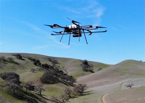
Drone-mounted LiDAR (Laser imaging, Detection, and Ranging) detects gold in placer claims by creating high-resolution 3D terrain maps that reveal hidden paleo-channels and geological structures such as fault lines where gold concentrates, allowing prospectors to see beyond vegetation to pinpoint gold-bearing gravels and optimize exploration before physical digging begins. LiDAR works by penetrating the foliage to map the "bare earth", highlighting features such as ancient riverbeds, and erosion patterns where gold naturally settles, revealing potential deposits invisible from the ground. While large resource companies use LiDAR mounted on aircraft or helicopters, drones can be operated at a fraction of the cost making the deployment of LiDAR something junior exploration companies can now afford.
Using LiDAR to Find Placer Gold Deposits
A LiDAR equipped drone can be deployed to pass over a claim and emit laser pulses which bounce off the ground to create what is called "bare-earth mapping". System software filters out the trees, bushes and vegetation, creating an acccurate digital elevation model (DEM) of the ground surface. The DEM uncovers subtle features such as ancient riverbeds (Paleo-channels) and flood plains where gold would have accumulated. Through analysis of the areas of high erosion potential bedrock exposure and gold traps can be identified. Geologists can then target areas with high-probability rather than random digging.
Key Benefits:
-
Penetrates Vegetation: Sees through forest growth to map of the ground beneath
- High Accuracy: Provides centimeter-level resolution for detailed mapping
- Efficiency: Covers large areas quickly, reducing project costs and timelines
- Safety: Reduces the need for hazardous ground exploration in rugged terrain.
Using AI to Analyze LiDAR
Bare-Earth Digital Elevation Models (DEMs)
AI algorithms process raw LiDAR data to remove vegetation and digital noise, creating "bare-earth" models. These models reveal subtle ground features that suggest placer gold deposits such as ancient riverbeds, benches and terraces where gold naturally settles due to water flow. It can also identify the original sources for the gold, such as lineaments, faults and shear zones.
Automated Feature Recognition
Machine learning models such as Convolutional Neural Networks (CNNs) and Random Forest (RF), are trained to automatically recognize signs of historical mining that often indicate remaining deposits:
- Historical Diggings: Automatically detecting collapsed shafts, old sluice lines, and hidden tailings piles.
-
Hydrological Sinks: Al-driven "sink detectors" can identify depressions in the terrain that may represent unrecorded mine shafts or natural collection points for gold.
Predictive Geospatial Modeling
AI intergrates LiDAR with other data layers to build complex prospectivity maps:
- Stream Power Indexing: AI calculates erosion and deposition potential across a landscape, highlighting where gold is likely to have accumulated based on historical water flow.
- Multi-Sensor Fusion: Deep learning models can combine LiDAR's 3D structural date with multispectral or hyperspectrual imagery to match topographical anomalies with "spectral fingerprints" of associated minerals like magnetite or iron oxides.
Real-Time Processing and Efficiency
Using an onboard AI system, drones can perform real-time data analysis during flight allowing for:
- Dynamic Pathfinding: Drones can autonomously adjust their flight paths to scan high-potential areas more densely.
- Cost Reduction: AI platforms can predict mineral targets up to 400 times cheaper than traditional drilling-heavy methods.